Dumoine River (sentierdumoine.ca)
This Event has already taken place, but here's some information about this new trail:
I am a hikeaholic. I also really enjoy backcountry camping, be it backpacking or canoe camping. I don’t white-water paddle, but I’ve heard how gorgeous the Dumoine River is and I grew up in the area. I have always wanted to see it for myself.
So, when an old (not in age but time gone by) high school friend posted on Facebook he was volunteering to help clear a new backpacking trail along the Dumoine, my ears perked up. I quickly expressed an interest in the trail. Knowing I sometimes lead backpack outings, he informed me that Wally Schaber was looking for groups to pre-hike the trail, called the Dumoine Tote Road Trail, before the official opening for fall 2022. And the adventure was on!
Wally is well known in the canoe community. Canadian Geographic says: “As the founder of Blackfeather Wilderness Adventures, and Trailhead Outfitters, for more than 50 years, Wally Schaber has led trips down Canada’s most iconic rivers, many in the arctic, like the Nahanni, the Hood, the Coppermine, the MacKenzie, paddling with everyone from former Prime Minister Pierre Trudeau, to his canoeing mentor, Bill Mason.”
One of Wally’s passions is the history of the Dumoine. He and fellow friends came up with the idea to build a trail along the old Tote Road Trail, a trail used by loggers who worked on the Dumoine River in this historic trade.
From their website: “There are several notable historic sites along the Dumoine Tote Road Trail including several stopping places with an agricultural history. At the height of the Timber Trade, thousands of men and horses lived and worked in camps all along the river. As a result, evidence of human presence can be seen frequently, presenting an exciting opportunity to connect to those who lived and worked here.”
The Friends of Dumoine volunteers have contributed countless hours on this project. They recut the trail, built bridges, established campsites and erected thunderboxes, a type of outhouse without a roof. If you have ever camped in the backcountry, you will certainly know what a thunderbox is!
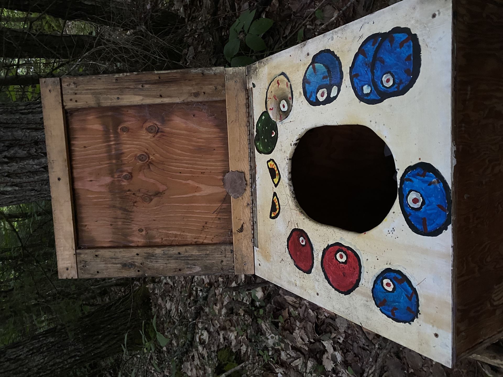
All the thunder boxes were hand painted by grade school children. Most were very strategically placed for the most shy but there was one for the exhibitionist and one for the very tall. Seeing the efforts of the volunteers’ hard work first hand is impressive. I’ve done some trail clearing myself, but nothing on this scale!
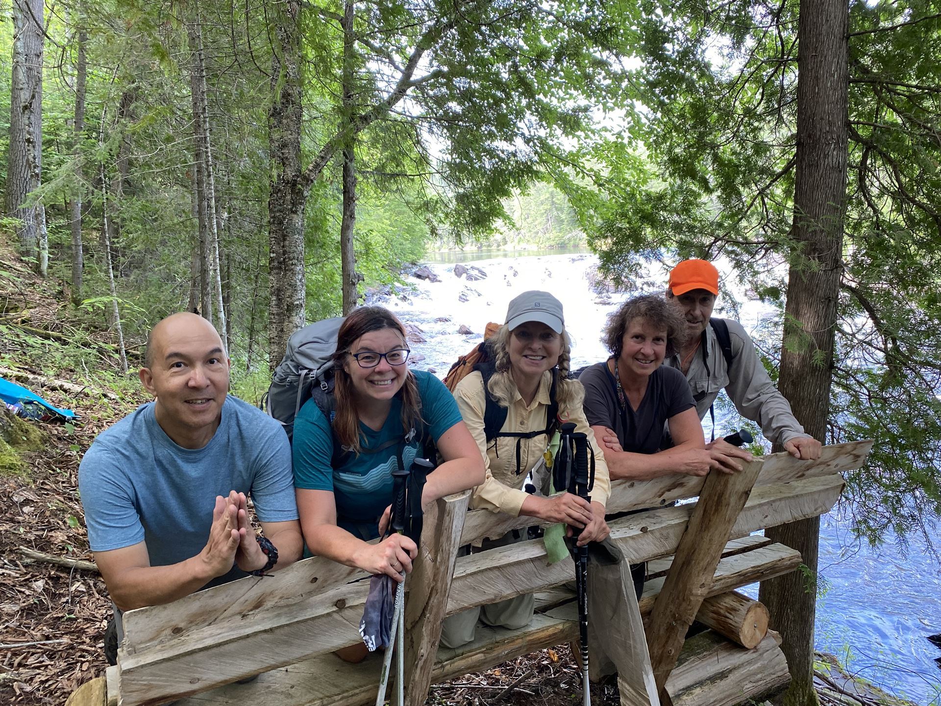
I posted this event for members of the Five Winds Backcountry Ski Club, a group I’ve backpacked with many times. Ten signed up but at the end, it was only five of us: myself, Lynn Calbeck, Louie DeLeon, Bob Stephenson and Becky Matthews. Our ages ranged from 49 to 70 years young. I set an itinerary for 3 nights, four days. I initially only intended on exploring the top part of the trail but I was in for a wonderful surprise at my parents’ house in Deep River, where we all got together on the night before the trip. Everyone in the group was interested in hiking the entire trail, not just once, but twice as a There and Back. This was going to be an ambitious endeavour but we were up for it!
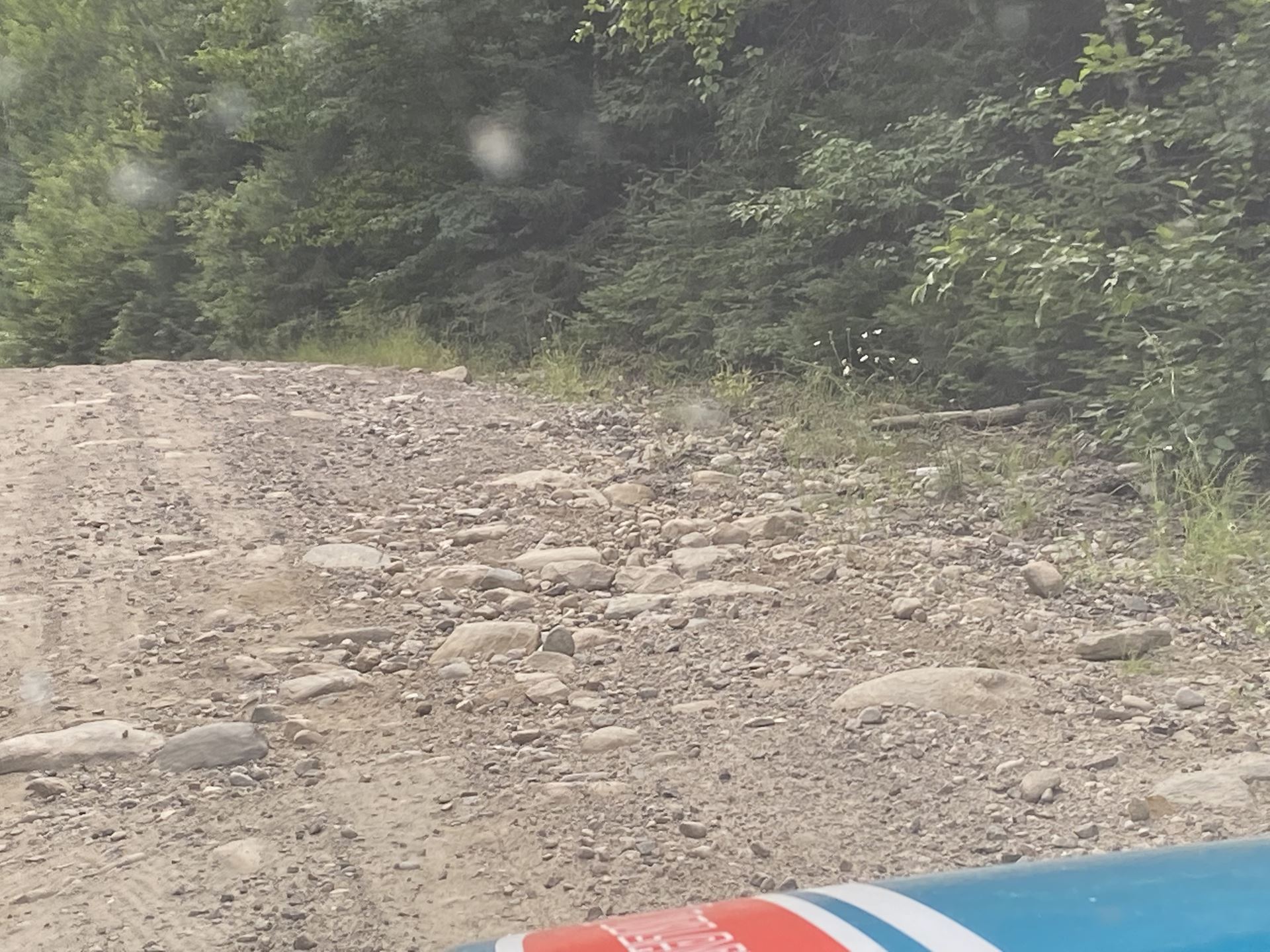
We set out in high spirits on Tuesday August 2. The drive in was long and bumpy, and so was the registration process. All went well with ZEC Dumoine, where we purchased our camping permits and parking pass. Camping costs $5 per day, and the parking $5 per vehicle per day, a bargain compared to most provincial park fees. However, we needed to get a $12 road permit from ZEC Swisha, who manages the road to Grande Chute, and much of the area on the east side of the river. The very nice lady at this ZEC office had not heard of the new trail and thought we had to pay her for our camping. We would have paid twice! Luckily, an older gentleman who knows the area well happened to be in the office and set things straight. I’m hoping we’ve paved the way for easier registration going forward. Bob took us all in his trusty van and cautiously negotiated potholes and rocks. It is doable, but go slowly!
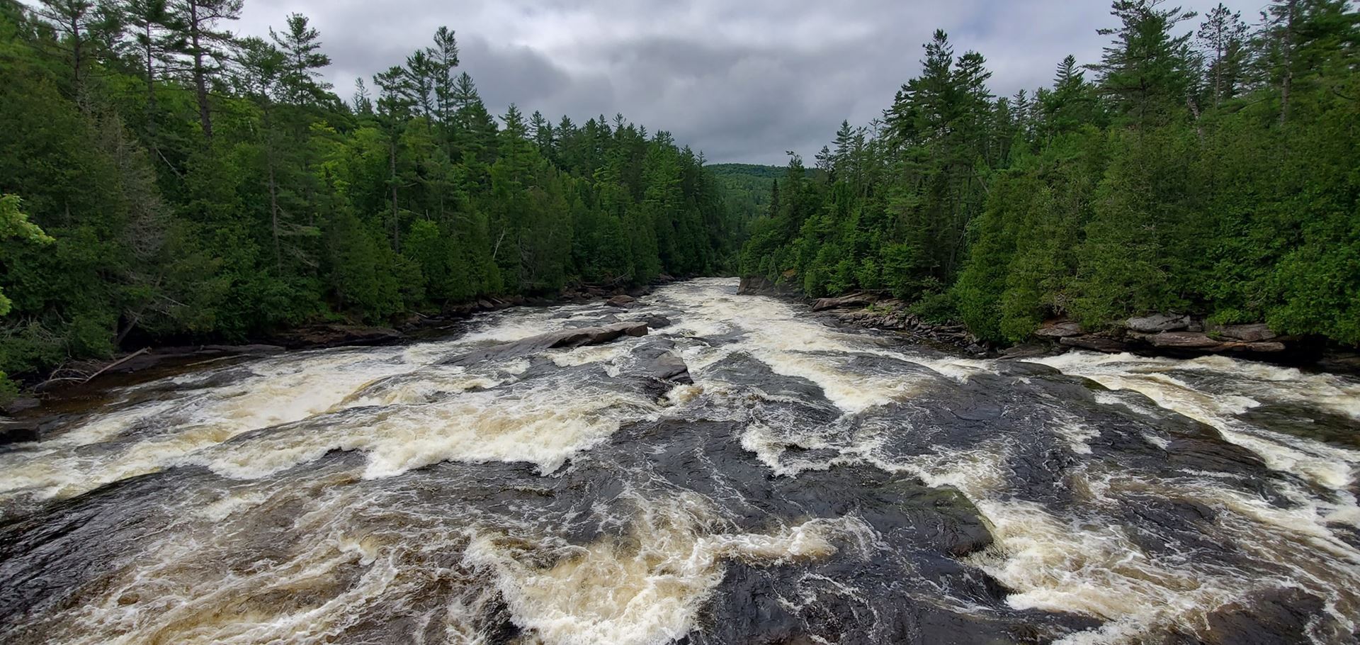
The bridge over the Dumoine River at La Grande Chute is over a gorgeous but raging torrent. You would not want to fall in here! The trail head is just west of the bridge and is nicely marked.
We really enjoyed the first 8 km of the trail. This is the loveliest portion, in my opinion. The trail has many roots and rocks, and the rain had made the boardwalks a bit slippery, so we had to go slowly and take our time.
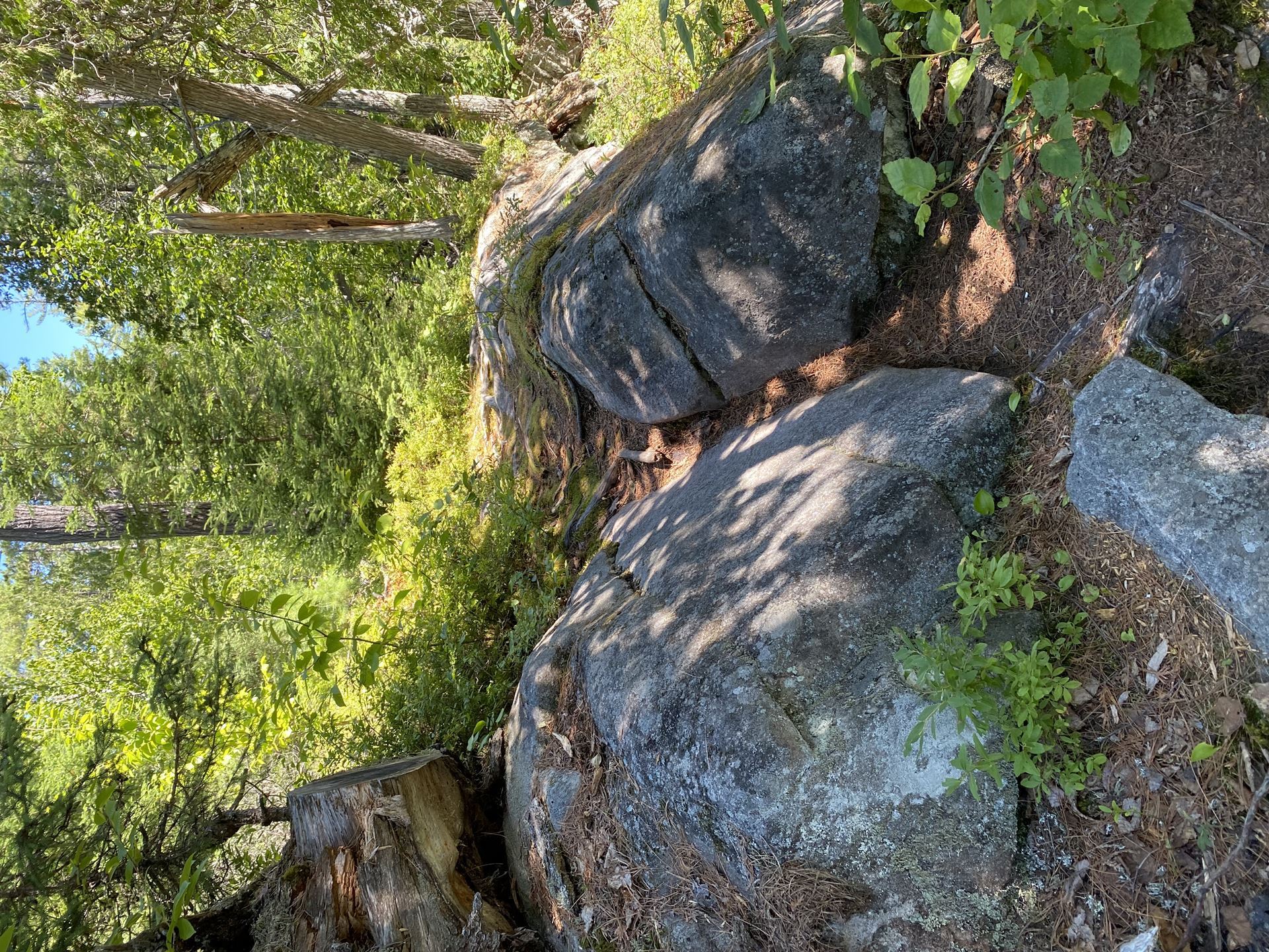
After a short while, however, the terrain became easier and our pace picked up. Trail markers were red with horseshoes, a tribute to the horses that were critical to the time period the Tote Road was used by the loggers.

We chose to take a shortcut shown on the map, marked as the Scenic Route. It was hard to find and we had to bushwhack a little. However, with the help of my handheld GPS and the map printed from the official website, we were quickly back on track. The shortcut was much easier to find on the return leg. We chose this option because it was described as being more scenic than the slightly longer portion on a dirt road. All the deerflies on the road also helped with the decision.
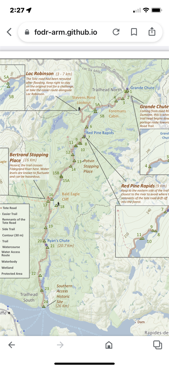
We debated stopping at campsite 8, the first site in our original itinerary. It is on a section of the river called Red Pine Rapids, and easily the most gorgeous campsite on the entire trail. Actually, the most gorgeous campsite I’ve ever stayed on. We carried on to campsite 15, having hiked 14 km with heavy packs and decided that would be home for our first two nights.
Day two was an ambitious plan. We decided to day hike to the Ottawa River and then return to campsite 15. Part-way, we had to ford the Fildegrand River, where the current wasn’t too bad but the water was thigh deep in places. In the spring, it is unlikely one can traverse this way and so two canoes are therefore left to help with the crossing. The DTRT web site has information on how to properly shuttle using these canoes.
The map said our day-hike would be a 24 km excursion, 12 km each way, but my GPS showed we had hiked 29 km by the end of the day! Man, were we happy to be back at camp!
Before the hike back, we had a lovely surprise. There was a person with clean clothes (ours were not) at the southern terminus. It was Ray, one of the volunteers who helped build and helps maintain this trail. Lynn calls him our Ray of Sunshine, a welcome sight on an overcast day. He called us B2 and L3.
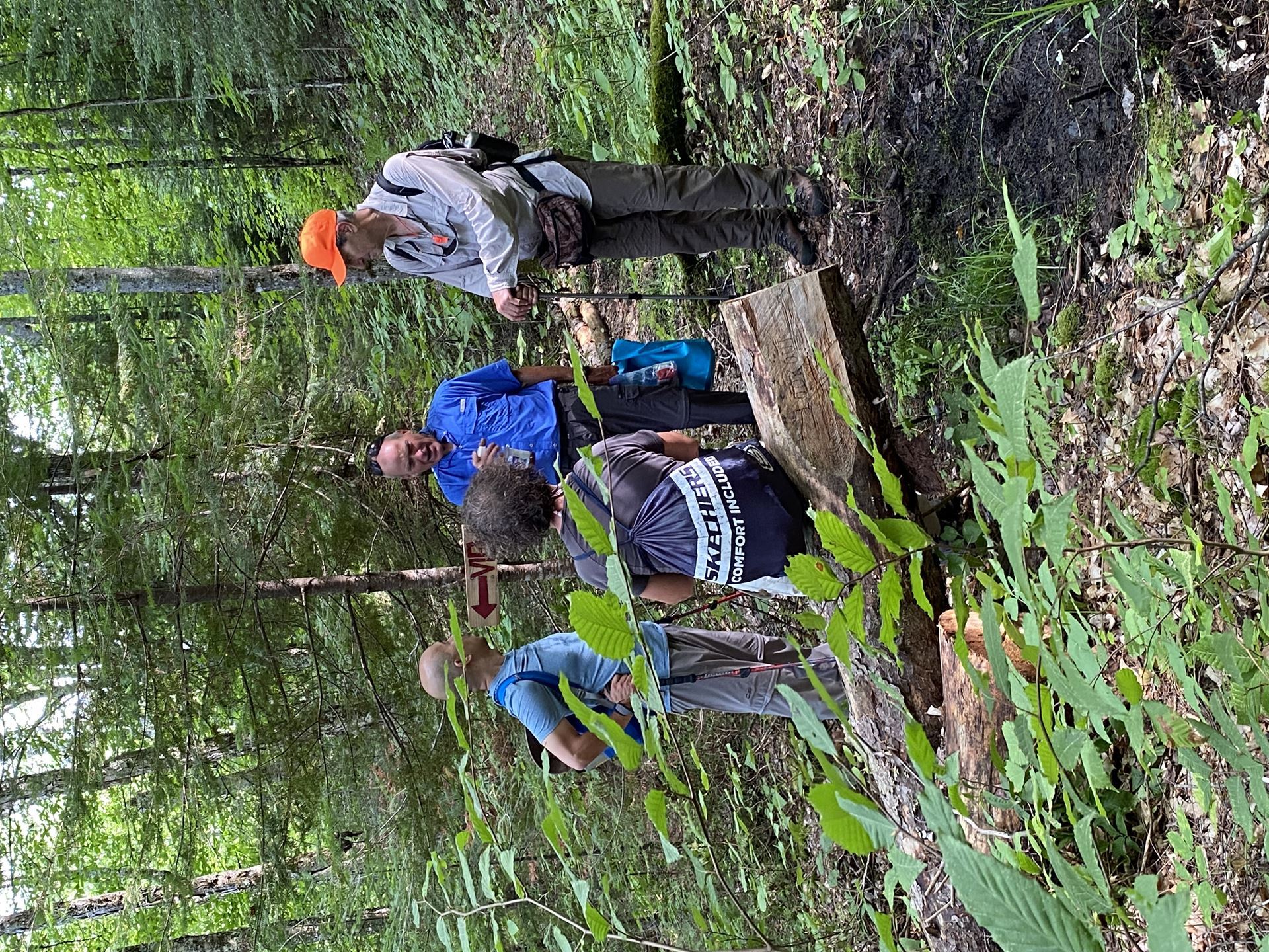
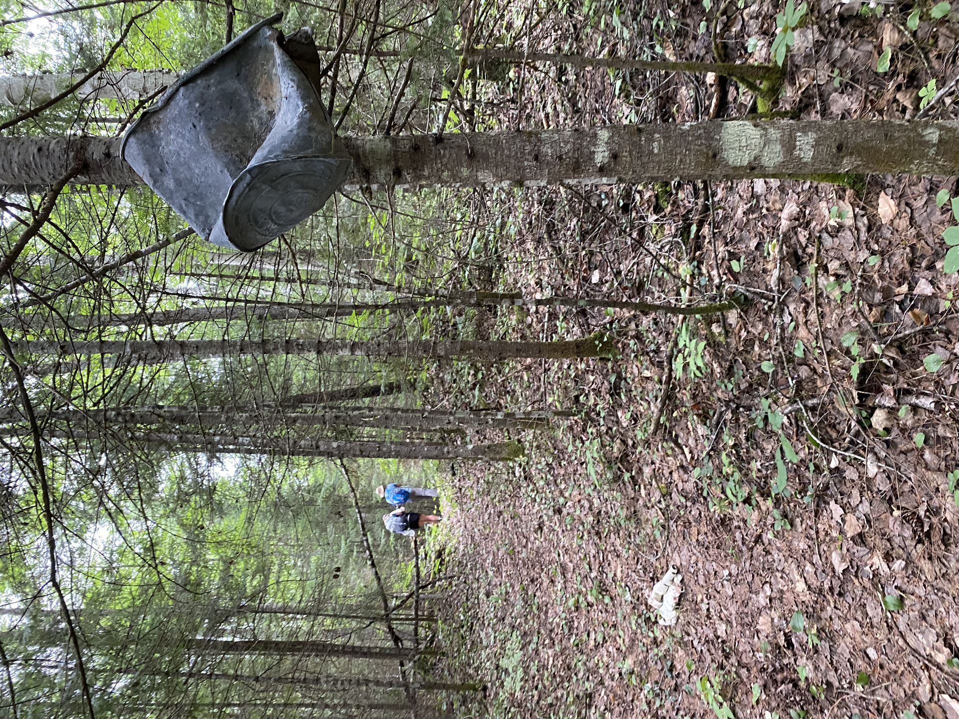
We hiked the first 2 km back toward camp with Ray, listening happily to his information about the trail and the historic artifacts we had seen earlier. He confirmed the wire along parts of the trail were indeed telegraph wire and that the trail had been dug out by hand for use by the loggers and their horses. Incredible! We told Ray we really liked how some old pots and pans decorated trees along parts of the trail.
Day three was an easy day. We needed it. We hiked back to campsite 8, where we swam, napped and chatted.
A lovely family from Quebec shared our site later that day. They had planned on going further but lots of distance on the river and some long tough portages made them too tired to continue. Lynn moved her tent so they could have two spots together at the north portion of the site, the area with some lovely rapids and an awesome swimming hole. Their daughter even caught a fish there for their dinner.
We delayed our departure so we could say goodbye to our new friends and watch them negotiate the rapids. Their paddling skills were impressive! Louie made sure to take lots of videos and offered to send them copies.
Some tree hugging and photo ops preceded their return to the river, and our last day of hiking back to our cars.
Backpacking in August can be tough. The first day wasn’t too hot but the next 3 days were, and the bugs were pretty hungry! Perhaps the animals were tired of being mosquito food and sent them to feed from the humans instead. I was very happy to have my head net and my “Insect Shield”-treated long sleeved shirt. Becky braved it all in shorts and a t-shirt. Louie and Bob had long pants but the bugs went after their heads and necks. Sometimes bug shirts were put on, despite making things even hotter! The best time to visit this lovely trail is likely in the early fall, when the weather is mild, the water is still warm for swimming, and the insects have decided to give humans and animals alike a break.
A quick swim once back at the cars was very welcome! Don’t worry, we stayed well away from the “Big Chute” and used the calm water at the north end of the portage to cool down. A drive back to Raides-Des- Joachims (“Swisha”) for some cold pop and a few snacks , then back to Deep River and our adventure was finished.
What were the prettiest campsites? I would recommend 3, 8, and 15. We never saw site 18, but it might be worth checking out since it has a view of Bald Eagle Cliff.
If you want to hike this trail, here are some suggested itineraries:
1/ For the history buffs or people wanting a challenge, do what we did.
2/ Or take some extra days, camp at Red Pine Rapids first night, site 15 the second night, site 24 at the junction of the Dumoine and Ottawa Rivers the third night, site 15/18 fourth night, Red Pine Rapids last night, then hike back to cars. This will be easier miles, but you’ll have to carry more food (weight)
3/ Do a linear hike, camping at above sites but not doing the trail both ways (ie twice). You will need to arrange for a shuttle. The information on how to do so is on the website.
4/ For people wanting to see pretty stuff with river views but not interested in history, only do sites 8 and 15. Or just site 8 (it was the most gorgeous place I have camped at to date). In other words, skip the south part of the trail.
5/ This trail can be day hiked, to site 8 and then back to the cars. 16 km in one day is very doable for the fit. (29 km is a bit over the top, LOL.)
Be advised this trail is very remote and not for beginners. You must be prepared. Bring a first aid kit and a satellite communication device such as a Spot, Garmin In-Reach or Zoleo. Have clothes for adverse weather and equipment to survive a night out, even if you are only day hiking. There is no cell phone service here! If you use a phone for navigation, bring a battery bank so you can recharge it. And a paper map plus compass, as you always should because technology can fail. You will need to treat your water to prevent Giardia and other water-borne diseases.
We encourage hikers to watch the video of the trail before they go and think about gifting a donation to the cause after they complete the trail.
For more information on this trail, check out their website: Dumoine River (sentierdumoine.ca)
By: Louise Langlais